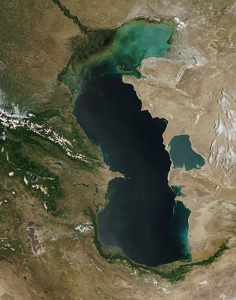
File:Caspian Sea from orbit.jpg

Dimensioni di questa anteprima: 471 × 599 pixel. Altre risoluzioni: 188 × 240 pixel | 377 × 480 pixel | 603 × 768 pixel | 804 × 1 024 pixel | 1 609 × 2 048 pixel | 4 400 × 5 600 pixel.
File originale (4 400 × 5 600 pixel, dimensione del file: 3,44 MB, tipo MIME: image/jpeg)
Cronologia del file
Fare clic su un gruppo data/ora per vedere il file come si presentava nel momento indicato.
| Data/Ora | Miniatura | Dimensioni | Utente | Commento | |
|---|---|---|---|---|---|
| attuale | 10:16, 14 Zógn 2010 |  | 4 400 × 5 600 (3,44 MB) | Originalwana | higher res |
| 16:10, 8 feb 2005 |  | 550 × 700 (67 KB) | Pixeltoo | Caspian sea by space Nasa |
Utilizzo del file
Nessuna pagina utilizza questo file.
Utilizzo globale del file
Anche i seguenti wiki usano questo file:
- Usato nelle seguenti pagine di af.wikipedia.org:
- Usato nelle seguenti pagine di als.wikipedia.org:
- Usato nelle seguenti pagine di am.wikipedia.org:
- Usato nelle seguenti pagine di ang.wikipedia.org:
- Usato nelle seguenti pagine di an.wikipedia.org:
- Usato nelle seguenti pagine di arc.wikipedia.org:
- Usato nelle seguenti pagine di ar.wikipedia.org:
- بحر قزوين
- ويكيبيديا:صور مختارة/الفضاء والكون/نظرة إلى الخلف
- ويكيبيديا:ترشيحات الصور المختارة/بحر قزوين
- ويكيبيديا:صورة اليوم المختارة/ديسمبر 2016
- قالب:صورة اليوم المختارة/2016-12-23
- مستخدم:قائمة أكبر البحيرات والبحار في المجموعة الشمسية
- ويكيبيديا:صورة اليوم المختارة/يوليو 2020
- قالب:صورة اليوم المختارة/2020-07-16
- ويكيبيديا:صورة اليوم المختارة/يوليو 2023
- قالب:صورة اليوم المختارة/2023-07-26
- Usato nelle seguenti pagine di arz.wikipedia.org:
- Usato nelle seguenti pagine di ast.wikipedia.org:
- Usato nelle seguenti pagine di as.wikipedia.org:
- Usato nelle seguenti pagine di av.wikipedia.org:
- Usato nelle seguenti pagine di azb.wikipedia.org:
- Usato nelle seguenti pagine di az.wikipedia.org:
- Usato nelle seguenti pagine di bat-smg.wikipedia.org:
- Usato nelle seguenti pagine di be.wikipedia.org:
- Usato nelle seguenti pagine di bew.wikipedia.org:
- Usato nelle seguenti pagine di bg.wikipedia.org:
- Usato nelle seguenti pagine di bh.wikipedia.org:
- Usato nelle seguenti pagine di bn.wikipedia.org:
- Usato nelle seguenti pagine di br.wikipedia.org:
- Usato nelle seguenti pagine di bs.wikipedia.org:
- Usato nelle seguenti pagine di bxr.wikipedia.org:
- Usato nelle seguenti pagine di ca.wikipedia.org:
- Usato nelle seguenti pagine di ce.wikipedia.org:
- Usato nelle seguenti pagine di ckb.wikipedia.org:
- Usato nelle seguenti pagine di co.wikipedia.org:
- Usato nelle seguenti pagine di cs.wikipedia.org:
Visualizza l'utilizzo globale di questo file.


